Thursday, November 19, 2020

11-17-2020 Valley of Fire

There remains but one last day here to explore the sights.  Valley of Fire was on Sunday’s agenda but we got delayed by the requisite Sunday “9-1-1 Special breakfast.”  At 2PM, with the sun beginning its descent and creating shadows, it became impossible to get a true appreciation of this incredible wonder.  So with an extra day to spare, the Valley of Fire was rescheduled for Tuesday.

Arch Rock

Balancing Rock - Who wants
to put money on when this thing
will fall?

Poodle Rock - See him?

Mother Nature began work on this creation millions of years ago.  Volcanos, shifting plates, ice ages, ancient seas and flooding followed by a desert climate continue to take turns changing the landscape of the earth.  Valley of Fire is no exception.  The colors derive from sandstone, silica, gypsum, iron, manganese and a host of additional elements that create the reds, whites, tans and blacks that we now see.  Much later, at the time of the dinosaurs, the area was covered by as much as 3,000 feet of sand that held everything in place.  As the winds blew the sands about, the rock formations stayed behind in the spectacular formations that we see today.  (That’s the Reader’s Digest version.)

18 feet deep sealed chasm
called "Mouse's Tank"
Humans have left their prints, of course.  One story tells of a Paiute named, “Little Mouse,” who in the late 1800s sort of went loony toons and started shooting up the Indians’ village.  He went on the lam and holed up in Valley of Fire near a natural deep well filled with clear clean water, a scarcity in this land.  He thrived for several months but when he decided to move along he was spotted by a posse.  He refused to surrender so they shot him.  As in, “dead.”  The natural 18-feet deep well is now called Mouse’s Tank and can be visited by taking a hike along the canyons covered with petroglyphs.  The petroglyphs were not painted on the rocks as we have seen elsewhere but they are scratched through the black surface of the rocks (created by deposits of iron and manganese reacting with other elements) to the lighter colored layer below it.
Hiking on Mouse's Tank trail

Wuhan Virus petroglyph

Rob and the Higher Glyphs


Some of the many petroglyphs on
Mouse's Tank trail


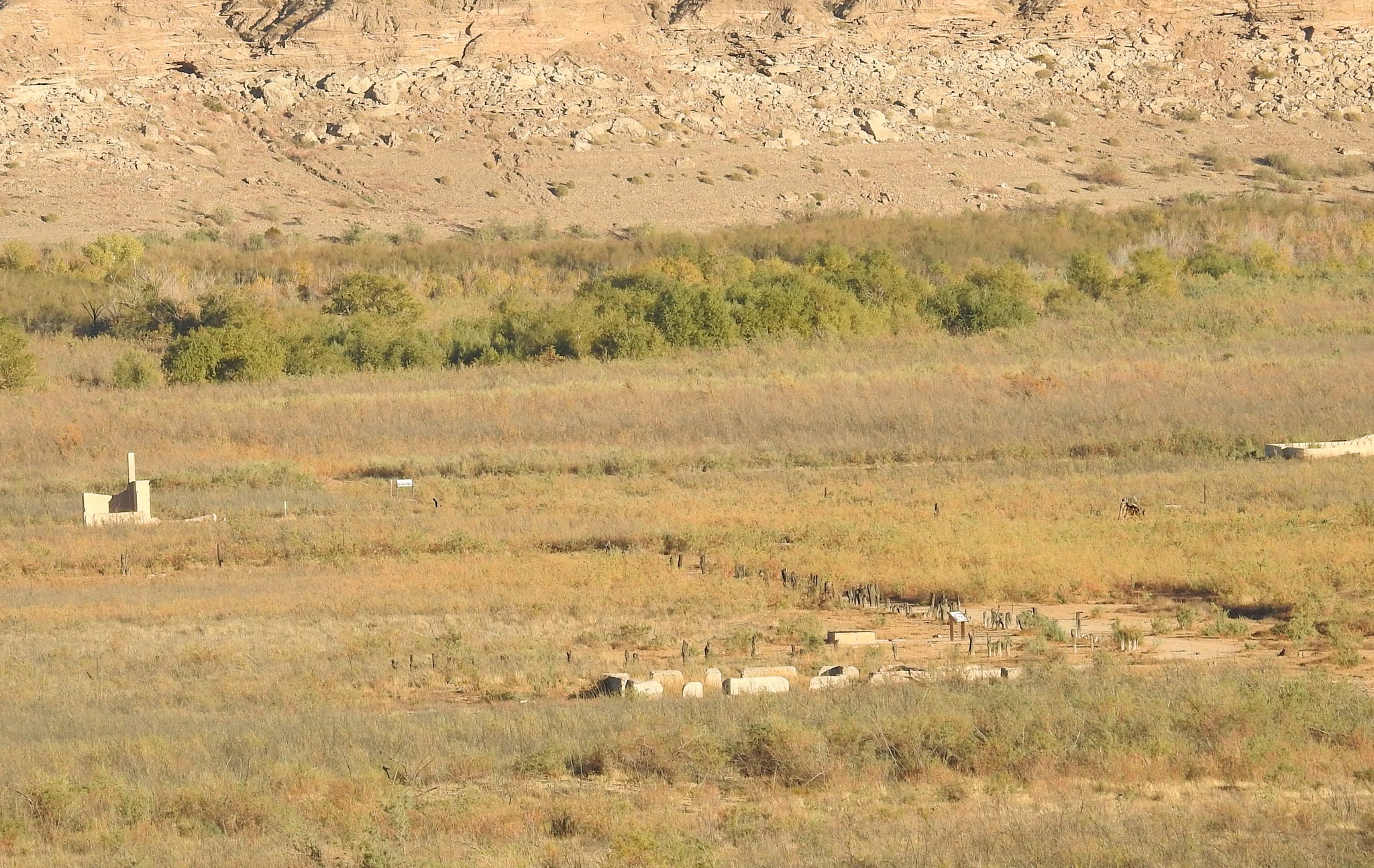
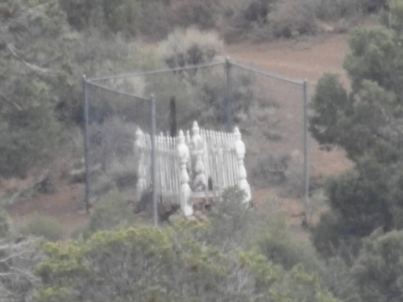
Sergeant John J. Clark's memorial
Another story involves a cavalry man, Sergeant John J. Clark.  After serving with honor in the Civil War and being discharged from service, he was traveling by horse-drawn buckboard through the valley on his way to Salt Lake City.  He stopped to rest and presumably to find a bit of water, to no avail.  He lie down in the shadow of his buckboard and died.  His horse died beside him.  A memorial monument out on a lonely hill honors Sergeant Clark’s life and heroic deeds but it isn’t clear if he is actually buried there.

Rob and the 1930s version
of the Holiday Inn Express


In more recent decades (1930s), the Civilian Conservation Corps built a few small cabins along the pathways to shelter weary travelers.  The cabins were not furnished with much, just a dirt floor and a fireplace but they provided respite from the unforgiving desert elements.  And they did offer free wi-fi.
 

White Dome - comprised
of gypsum, mostly


It is easy to spend several days in the Valley of Fire, hiking to the more famous of the rock formations and stopping for a sip of water and a sandwich at one of the picnic areas overlooking the spectacular vistas.  It was a wonderful place to spend peaceful hours soaking in Mother Nature’s tireless creativity.

That’s all for this time.  Time to pack up Noobee and head back to the insanity.  Thanks to all of you, my dear t-loggers, for coming along on this little getaway.  I send you hugs and kisses, even if they are illegal and of course lots of love!  Have a wonderful holiday season!


Monday, November 16, 2020

11-16-2020 St. Thomas, NV

Echo Bay International Airport
 On our way to today’s explorations, we couldn’t resist jumping off the road to have a quick look at Echo Bay International Airport, accessible by a rough, gravel road.  Not much activity going on at the airport, though.  I’m not sure what a round-trip ticket might cost since we didn’t find a terminal where we could make inquiries.


The runway

 St. Thomas was settled by the Mormons in 1865 on the banks of the confluence of the Muddy and Virgin Rivers where the soil was very fertile for farming.  When the government came along (It’s always somethin,’ Jane.  Usually, the government.), they finalized the state boundary line between Utah and Nevada, moving it east just enough to situate St. Thomas in Nevada instead of Utah.  As a consequence of this, the damned government told the people that they owed Nevada six years of back taxes.  The Mormons asked Brigham Young what they should do.  He advised the citizens to take a vote and all but two people  (out of 45 families) voted to say, “Fuck you,” and abandon St. Thomas for parts further into Utah.  As a parting shot, they engaged the “scorched earth policy” and destroyed the town with fire.

The white part is what NV
looked like then.  The blue
part is what they called
the new boundary.

Rob and a deep cistern


A pioneer woman drawing water
from the cistern

Other settlers moved into St. Thomas later and developed a fairly prosperous settlement.  Trains came along and delivered supplies and ice to the folks and they were thriving quite well.  They had cisterns for water that they dipped by the barrelful out of the river.  Ashes, charcoal and sand were thrown into the water and acted as a natural filter.  “Refrigerators” consisted of wooden boxes wrapped in burlap.  The burlap was soaked in water and the wind kept the boxes cool.  They were raised up on stilts and the stilts were sitting in glasses of water to keep the ants out.
This is what is left of St. Thomas, NV


Lindy and the foundations of a home
in St. Thomas

 In 1928, along came President Coolidge and the concept of Hoover Dam.  By 1935, the dam was a reality, it was dedicated by FDR, gates were closed by 1936 and the water began to rise.  St. Thomas was a distant memory and flooded under 70 feet of Lake Mead by 1938.  In recent decades, receding water has revealed what is left of St. Thomas:  just the foundations of a ghost town.  We found the trail head of a 2.5 mile hike to the ruins of the settlement.  Being as old as we are, it took an afternoon for us to make the hike, stopping along the way to catch our breath, take a chug of water and examine placards and foundations. 

 Along our way, we encountered sheep, wild horses, burros and one lone coyote howling up on a ridge.  A very interesting, fun day!


Sunday, November 15, 2020

11-14-20 Callville, NV and Driving Around

 What beautiful country this is!  The rocks look like they are smoldering:  bright red, orange and yellow.  They are set off in contrast with blue and gray mountains and a royal blue sky.  Millions of years ago, volcanos and earthquakes created rifts, sand dunes and deep, sharp canyons that we shall see today.  Each time we came around a bend in the road, there was a more amazing sight.  “Wow!  Slow down!  Look at this!”  Over and over we were treated by Mother Nature’s artistry.  We arrived at our campground late in the afternoon but in time to quickly set up camp, pour a toonie and watch the sun slip behind the mountains.


Noobee at Lake Mead
RV Village

It was a slow start this morning because the clocks had been reset to island time.  No rush.  Coffee,  jammies and puzzles in the sunshine.  What shall we do today?


Lake Mead is enormous and unbelievably blue.  Mathematically, it looks to cover about 100 miles as the crow flies (on the map), three arms create a three point star shape kind of like a Mercedes ornament.  It is fed mostly by snowmelt off the Rockies so when they get snow, Lake Mead gets water.  When the Rockies have a less snowy winter, Lake Mead recedes.  The clean, clear blue water is explained by the snowmelt that feeds the lake.


Echo Bay marina


Echo Bay is located on the western bay of the Overton Arm.  The water has receded to its lowest depth since 2016 and the marina is accessible by a new, lower ramp.   There are many fishermen, ducks and other seabirds and campers along the water.  Humans evolved from the water, humans gravitate back to the water.  The fishermen are in fish paradise.  The lake is the home of several brands of bass, bluegill, trout, catfish, shad and razorback shuckers.  Oh My God, take me to your chef!  We drove along the shore of Echo Bay, a rough, rocky drive where there were rugged tent campers pitched and fishermen casting lines.  It would have been dreamy to be seaside here but we did not envision Noobee navigating the steep irregular trail. 


The water was up to the 
white arrow in 2010

We wanted to investigate Callville Bay but we passed it on the way to our campground.  So today, we decided to backtrack about 30 miles to see what Callville was all about.  Callville was a port established by the Mormons in 1869 (named for Anson Call under orders from Brigham Young) and it was meant to be a port to ship supplies to Salt Lake City.  Callville was flooded when Lake Mead was created.  The marina still exists and avid fishermen still launch here.  While poking around, we saw pictures of what Callville Bay marina looked like as late as 2010.  The water has receded so much since then that they have had to rebuild the ramps and the marina here, also, to accommodate the lower water levels.


Lindy in the Red Rock Apartments

As we drove along the byways, we had to stop here and there because the red rock vistas in the sunset were not to be passed by.  The story of planet Earth cannot be spelled out in brief.  Billions of years ago, it was a fiery ball.  Then it cooled.  There were volcanos and ice ages.  Then winds and deserts.  The red rocks that stand before us now were buried at one time beneath 2,000 feet of sand.  As the winds blew the sands away (To where, I wonder?), the beautiful red rock formations were left behind.  Some are called the Redrock Apartments, where snakes and coyotes now live.

Rob holding up the rocks


The Callville Marina Bar and Grill welcomed us at sunset for a catfish and fries dinner.  What a nice way to end the day of exploration!

Friday, November 13, 2020

11-13-2020 Introduction to a Short Fall Trip

 Maybe the authorities will scold us, “OK, don’t say you weren’t warned!”  Our governor, Emperor Sisolak, has “strongly suggested” that we Nevada citizens all lock down for 14 days.  He decrees that if we do not abide, he will… well… I supposed haul millions of us away in handcuffs or something.  (We’ve also been threatened if we get together with family and friends for Thanksgiving.)  All that said, Noobee is all packed up, aired up, watered up, gassed up, dieseled up and boozed up and we are on the road.  We had no choice.  How long can you sit at home?  How much TV can you watch?  So we are headed east to visit Valley of Fire,  not too far from the shore of Lake Mead, that marvelous enormous, blue, inland sea created by one of the wonders of the world, Boulder Dam.  Our effort to explore this beautiful state and learn about its history and geography continues.


One casual observation:  It takes just as long to outfit and rig up Noobee for a six-day trip as it does for a 3-month trip.  Just sayin.’


So, The DeLaMare Outlaws have joined the others who defy the authorities as we sit in rush hour traffic traveling through Las Vegas to our destiny:  Lake Mead RV Village at Echo Bay.  Look for us on Tucker Carlson.  Or in jail.  Maybe we’ll open a “gofundme” page!  Send bail money!


Four days of adventures and stories forthcoming!

Sunday, August 2, 2020

7-30-2020 Mina, NV


We five.
George, Kevin, Kathy, Lindy and Rob
A quick drive to Mina (125 mi.) was nice, for a change.  Because we haven’t seen them for so long (a month) and because they love us so much, our Pahrump neighbors, George and Kathy, decided to meet us for the 4-day stay.  Son Kevin from Reno also joined us.  In all our years of camping, I can’t remember anybody joining us at a campground before.  How fun is this?!


This is the size of the animal whose
bones are found in the pit.
George and Kathy have explored this area in the past and knew the interesting things to see.  Our first tour took us on a road east and up to 7,000 ft. above current sea level.  The word “current” is important because millions of years ago, this area was submerged in an arm of the Pacific Ocean, a whole different measure of “sea level.”  Ichthyosaur State Park was once underwater and the monsters that lived in this area, called, “fish lizards,” were massive mammals that lived in the sea but breathed air.  As the tides went out and the oceans dried up and receded during a warming age (this happened before the automobile), these ichthyosaurs became stranded, beached in the mudflats. 

Rob and Old Icky


Three dinosaurs altogether... 
Hundreds of them died and their skeletons became petrified and fossilized.  They were later uncovered by scientists who have determined that these whale-sized creatures were alive about 200 million years ago and lived on Earth for about 135 million years.  They had a long, pointy head and paddles (flippers) rather than feet and they gave live birth as some fossils have been found actually in the process of birthing a baby (named Little Icky, no doubt).


Sketch of the skeleton of an Ichthyosaur


Lindy in the machine shop - Berlin mines
Berlin mines mill
Near this park are the mines at Berlin, NV.  It is a ghost town now and the mines, of course, are abandoned, but it is always fun to imagine what life would have been like a hundred years ago out here in this desolate place where Lindy would have been found in petticoats, bloomers, a long skirt and a bonnet.  At its peak, the population of the town was about 250, miners, foresters and charcoal makers, a doctor, a nurse, a teacher, blacksmith and other machinists and, of course, a prostitute.  The silver haul from Berlin in 1900 totaled a significant $849,000 ($26,055,810 today).

Seems the humans of the 1800s and 1900s spent a lot of time “digging.”  Nevada is dotted with hundreds of small old abandoned mines.  Some were successful for a while, hauling away salt, basalt and gypsum and when the diggers got lucky, precious metals.  We drove many miles on the gravel back roads finding remnants of earthen huts and caves and old mine entrances, abandoned and sealed off.  “Nope, nothin’ here.  Let’s go dig over there.”  Belleville was a fairly large township that was elaborately terraced.  It functioned as a mill for ore that was brought there from the nearby Candelaria mine.  The sign describing the ghost town of Belleville says that it was “famous for murders, drunken brawls and ‘sporting.’”  In a town of 500 people with 7 saloons, the art of “sporting” can be left to our imaginations but maybe we can assume that it involved chicks.  As technology advanced, business slowed in towns such as this and Belleville was abandoned in 1892. 
Thirty-six stars on Old Glory,
one added to welcome Nevada
into the union


Time out for a picnic in Ione, N

Ione is described as "the town
that refused to die."  This residence
raises a few doubts in my mind.
Ione, NV was once the seat of Nye County and was founded in 1863, a year before Nevada became a member of the USA as its 36th state.  Finding a shady spot for lunch was a challenge in the three days we spent driving around the Nevada desert in search of ghost towns.  Ione is still populated by maybe 6 hearty souls and a small park in the little town with a picnic table under the shade trees provided the perfect spot for a picnic.  The good folks of the old town of Marietta had the decency to build a wall a hundred years ago so that, today, we could huddle into a shady spot for a beer and a sandwich. 


These are the surviving walls of
Smith's General Store in Marietta
Finally, dusty, hot and tired, we five have exhausted our curiosity of antiquity (for now) and last evening we settled in for a steak dinner accompanied by fine red wine.  Today, we packed up and hugged each other “good bye.”  Our next stop:  1640 Red Rock Drive.  It has been a fascinating month for Rob and Lindy.  Noobee did a fine job and we are home safe and sound.  That’s all the stories I have left in my fingers.  Till next time, love to you all.


Tuesday, July 28, 2020

7-26-2020 Fernley, NV


Nobody knows why this town got the name, “Fernley.”  In fact, it all began in 1902 when a few farmers got together and thought this would be a good place to grow some crops because of an irrigation project on the Truckee River.  So they were all happily growing their beans and corn and then the railroad showed up.  By this time, the community had decided to call itself, “Fernley,” and the railroad decided it was a good place for a siding.  In 1908, they got a Post Office and by 1910, Fernley had 159 belly buttons.  The rest is history.  Now, there are about 20,000 Fernleyans.  This is the Reader’s Digest version.  (And yes, they have a Walmart.)

What's left of Fort Churchill

Hospital at Fort Churchill

Officers' quarters
A bit south of Fernley, Fort Churchill was established in 1860, with the usual goal of protecting settlers and travelers against Indian aggression.  Capt. Joseph Stewart was in charge of building the fort and being no dummy  he named it for his boss, Sylvester Churchill, Inspector General of the Army.  Their job also included protecting the overland routes of the Pony Express.

The Fort was intended to be a permanent installation and was built on stone foundations and structures made of adobe.  It was ¼ mile square, buildings all around the sides with a big center courtyard.  The buildings included barracks, six officers’ quarters and a hospital.  Plans change.  In 1869, the military had decided the job was finished and the fort was abandoned.  Enter Samuel Buckland, who bought the whole shootin’ match for $750 US. 
"We're going out there and then
up and over those mountains, right?
Ummm.... why?!"

Buckland Station
Sam Buckland was an entrepreneur, farmer and rancher.  He supplied the military, the emigrants and the local community with food, supplies and horses.  He established Buckland Station, a Pony Express stop where the riders were supplied with fresh mounts to continue their ride.  Sam, the new owner of the abandoned fort, stripped it of structural materials and used some of them to build Buckland Station where he and his wife, Eliza, lived.  Sam, Eliza and 5 of their 8 children (ages 8, 2, 1, 2 days and “infant no dates”) are buried at Fort Churchill and are the only remaining graves.  The 44 servicemen’s graves have been moved to a military cemetery in Carson City.

Pony Bob

The Buckland family gravesites
One of the more famous Pony Express riders was Robert Haslam.  He regularly rode the route between Tahoe and Buckland Station.  His famous record ride was 120 miles in 8 hours and 20 minutes while wounded.  The message he was carrying?  Abraham Lincoln’s Inaugural Address.  His nickname was “Pony Bob,” what else?

Virginia City is a day trip from Fernley and it begged.  We just had to drive by our 10-acre “dream lot” to see what the new owners had made of it, for one thing.  We wanted to try to find my friend and boss’s grave (Ed G.) at the local cemetery and leave a few flowers.  It seemed it would be easy in the small cemetery but after an hour of searching in the hot sun, we gave up and laid the flowers on the grave of a Marine who had served in WWII.  Another goal was a cold Bucket of Blood Amber Ale and a bit of country music at the Bucket of Blood Saloon on the old boardwalk in the city.  This was accomplished. 
While you're standing there, Rob,
order me a Bucket of Blood Amber Ale!

Julia Bulette
When it came time to head for home, another storm was brewing and that seemed like a good signal not do that.  Instead, we waited for the storm to pass with a quick sandwich and fries at Virginia City Joe’s on the deck overlooking the hills beyond the city.  Joe’s used to be the Julia C. Bulette Saloon, CafĂ© and Red Light Museum.  The hookers’ museum used to be in the downstairs rooms.  Gotta think… what kind of artifacts would one find in a hookers’ museum?  It’s a curious place.  “What do you think this device did, Rob?”  Julia Bulette was the most well-known and loved of all the hookers in town.  She was a madam, hooker, philanthropist and a volunteer firefighter aside from her “day job,” as it were.  In 1867, at the age of 35, she was brutally bludgeoned and strangled to death.  Firefighters provided a mahogany coffin with silver handles and her funeral brought the entire town together.  When it came time to bury her, though, the Catholics resisted burying a lady of this “profession” on sacred Catholic ground.  So her last “getting laid” was getting laid to rest… well… you know….  somewhere out there in the hills, not many know where.  By the way, John Millian made the mistake of bragging about killing Julia for her jewelry and other valuables.  It didn’t take long to convict him and 4,000 people (including Mark Twain) witnessed his hanging.  Message:  Never, never, ever murder a town’s favorite hooker!
Julia's grave is out there somewhere.


Not to worry!  The Camera From Hell
may have found it!  I mean, how many graves
are out there, right?!